Innovative Offshore Solutions for the Marine Industry
Ocean Science & Surveying Pvt. Ltd. provides comprehensive Offshore surveying and support for a variety of sectors, dedicated to creating a safer world.
Pioneering Marine Survey Excellence
Ocean Science & Surveying Private Limited is an ISO certified company providing specialist multi-disciplinary marine survey support across the globe.
We deliver cutting-edge solutions to the Oil and Gas, Telecommunications, Energy & Renewable, and Marine Infrastructure market sectors with uncompromising commitment to quality and safety.
4 Standards
ISO Certified
100+ Professionals
Expert Team
10+ Countries
Global Reach
50+ Years
Combined Experience
200+
Projects Delivered


Why Choose Us?
Our commitment to quality, safety, and technological advancement sets us apart.
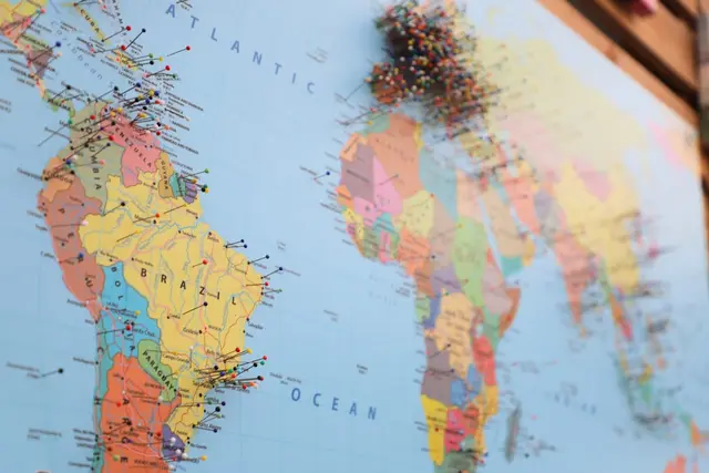
Global Project Map
Explore our survey projects across the world with interactive mapping technology.
Ready to Start Your Project?
Our team of experts is ready to provide tailored marine survey solutions for your unique requirements
Ocean Science Profile
Innovative Engineering and Geophysical Solutions for the Marine Industry.
Company Overview
Ocean Science & Surveying Pvt. Ltd. (OSS) is India's premiere Marine Survey & Geospatial Services provider for Renewable Energy, Oil & Gas, Telecom, and Marine Infrastructure industries. Based in Navi Mumbai, OSS offers a seasoned team with a cumulative 300+ years of experience providing geophysical, geotechnical, and environmental survey solutions to a wide variety of private sector, public sector and MNC clients in India, Middle East and Southeast Asia (Indian Ocean Region).
Ocean Science is a professionally managed organization comprising former Indian Navy officers and highly experienced, well-regarded professionals from the maritime and offshore industry.
Quality Data
Cutting-Edge Technology

Expert Team
Multidisciplinary Expertise
Advanced Technology
3000m
Geotechnical Depth
100+
Projects Completed
24/7
Operations Support
Global Reach

Serving clients across multiple continents with local expertise.
Reliability
Consistent delivery of high-quality marine survey solutions
Innovation
Leading-edge technology and methodologies
Excellence
Commitment to the highest industry standards
Our Valued Clients
Our Services
Comprehensive marine solutions tailored to your project's needs.
 Marine Surveys
Bathymetry Survey
A bathymetric survey is the process of mapping the seafloor. It involves collecting data to measure the depth of water and to chart the underwater topography. This data is essential for various applications, including navigation, coastal engineering, and marine science.
- High-Resolution Seafloor Mapping
- Navigation Channel Charting
- Coastal Engineering Support
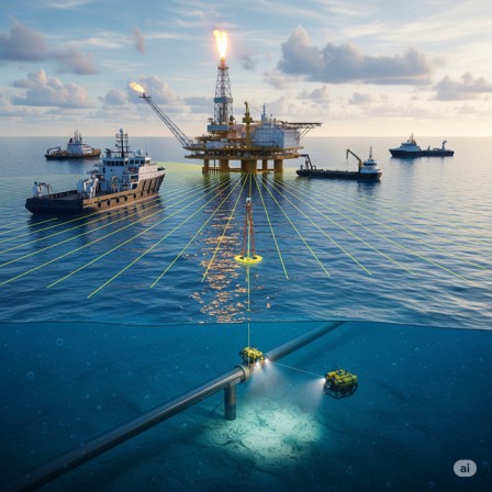
Offshore Platform Site & Pipeline Route Surveys
Offshore platform and pipeline surveys are critical for the planning, design, and safe installation of subsea infrastructure. These specialized surveys gather detailed data about the seafloor and sub-surface conditions to mitigate risks and ensure the long-term integrity of offshore facilities.
- Platform Site Investigation
- Pipeline Route Planning
- Subsea Infrastructure Support
 Offshore Solutions
 Telecommunications
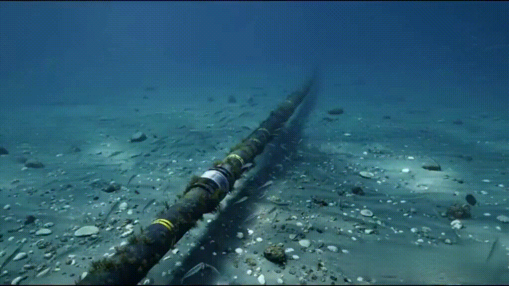
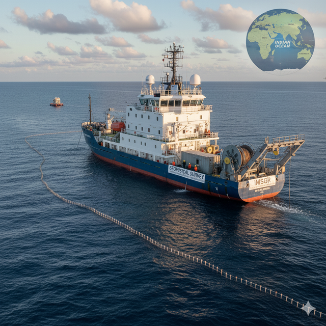
Submarine Cable Route Surveys
Submarine cable route surveys are essential for the successful deployment and long-term operation of underwater communication and power cables. These surveys meticulously investigate the seabed conditions along the planned cable path to identify and mitigate potential risks, ensuring the cable's protection and reliability.
- Cable Route Hazard Analysis
- Seabed Condition Mapping
- Burial Assessment Surveys
Topographic Survey
A topographic survey is a detailed map of the physical features of a piece of land. It provides essential information for a wide range of projects, from residential construction to large-scale engineering works. This information is crucial for architects, engineers, building contractors, and property owners to make informed decisions during the planning and design phases of a project.
- Land & Coastal Feature Mapping
- Construction Site Planning
- Engineering Design Support
 Land Surveying
 Subsurface Imaging
Geophysical surveys
Geophysical surveys are a vital tool for locating and mapping objects and features buried underground or underwater without the need for excavation. These surveys are essential for a variety of projects, from environmental assessments to construction and archaeological investigations.
- Side-Scan Sonar Surveys
- Sub-Bottom Profiling
- Geohazard Identification
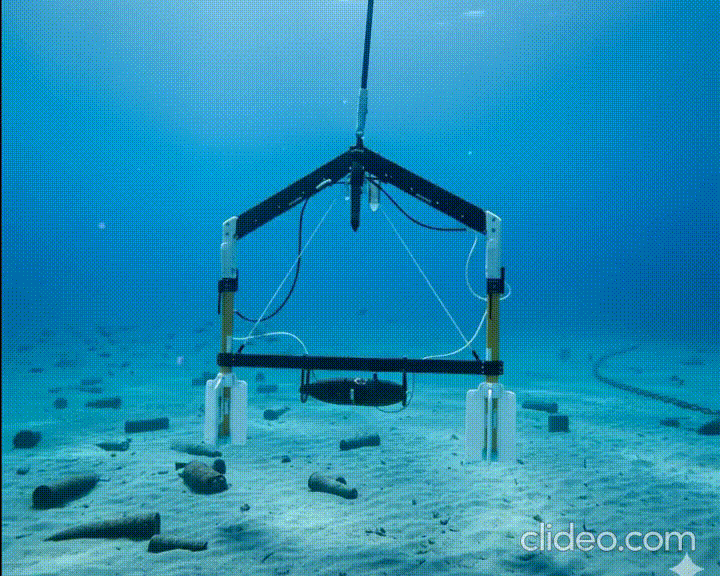
Gradiometer Surveys for UXO Search
Gradiometer surveys are a vital geophysical technique used to detect Unexploded Ordnance (UXO). They measure the magnetic gradient of the earth's magnetic field, which is the rate of change of the magnetic field strength over a distance. UXO, being ferromagnetic, cause local anomalies or distortions in this field that gradiometers can identify.
- UXO Detection & Mapping
- Magnetic Anomaly Analysis
- Site Clearance Certification
 Safety & UXO
 Environmental Data
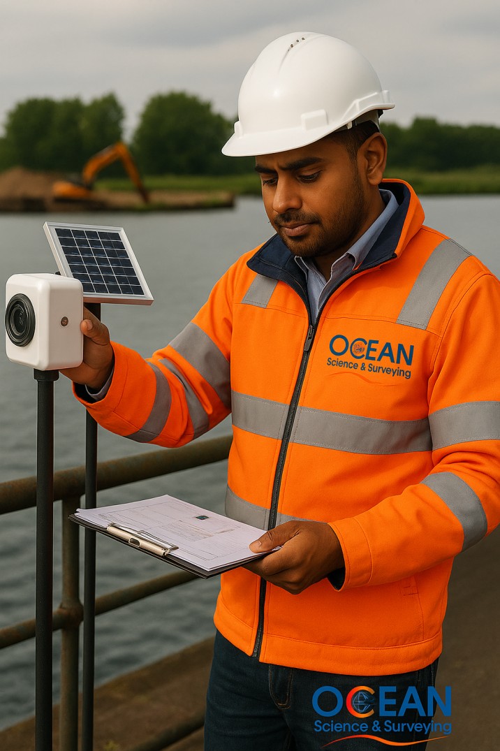
Shallow & Deep Water Oceanography
Shallow Water Oceanography, also known as coastal oceanography, focuses on the ocean environment from the shoreline to the edge of the continental shelf, typically to a depth of about 200 meters. The defining characteristic of shallow water is that its depth is less than half the wavelength of a surface wave, meaning the waves are significantly influenced by the seafloor.
- Current & Wave Measurement
- Water Quality Sampling
- Environmental Impact Assessment
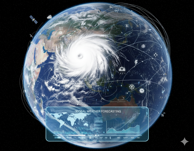
Weather Forecasting Services
Weather forecasting services use a combination of science, technology, and observation to predict the state of the atmosphere at a future time. These services are vital for public safety, transportation, agriculture, marine construction and various industries that are sensitive to weather conditions.
- Marine Weather Forecasting
- Operational Planning Support
- Metocean Data Analysis
 Metocean
 High Precision
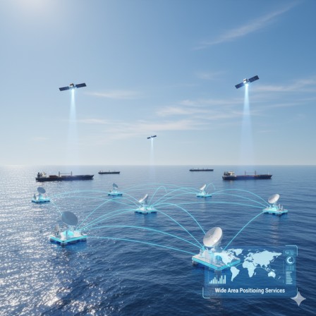
Wide Area Positioning Services
Wide Area Positioning Services (WAPS) are a type of augmentation system that provides improved accuracy for standard satellite navigation systems like GPS, GLONASS, and Galileo. These services use a network of ground-based reference stations to monitor satellite signals and broadcast correction data to users over a wide geographical area, enhancing the precision of positioning.Ocean Science provides & installs Veripos Marine GNSS Correction Services for survey and many commercial vessels all over the Indian sub-continent.
- Veripos GNSS Correction
- Vessel & ROV Positioning
- Subsea Metrology
Why Choose Our Services?
Decades of expertise, cutting-edge technology, and unwavering commitment to excellence
ISO Certified
Accredited with ISO 9001:2015, 14001:2015, 45001:2018 & 29001:2020.
Expert Team
Multidisciplinary specialists with decades of combined experience.
Global Reach
Operating worldwide with local expertise and support.
Safety First
Uncompromising commitment to safety and risk management.
Precision Technology
State-of-the-art equipment for accurate and reliable results.
24/7 Support
Round-the-clock operations and client support services.
Ready to Start Your Project?
Our team of experts is ready to provide tailored marine survey solutions for your unique requirements
Our Resources
State-of-the-art equipment and cutting-edge software powering precision marine surveys worldwide.
Advanced Hardware
Industry-leading technology for precision marine survey operations.
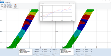
Bathymetry Systems
Advanced multibeam echosounder (MBES) for detailed seafloor mapping.
- Multibeam Echosounder
- High-Resolution Mapping
- Real-Time Processing
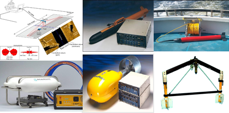
Geophysical Systems
Geophysical equipment for subsurface imaging (SSS, SBP, Magnetometer).
- Magnetic Sensors
- Seismic Analysis
- 3D Imaging
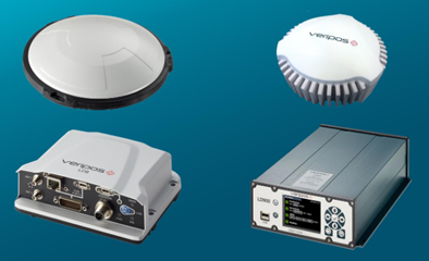
Positioning Systems
High-precision GNSS positioning technology (Veripos, RTK).
- RTK Corrections
- Sub-meter Accuracy
- Wide Area Coverage
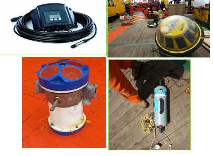
Oceanography Equipment
Instruments for measuring marine physical and chemical conditions.
- ADCPs (Current Profilers)
- CTD Probes
- Wave Buoys
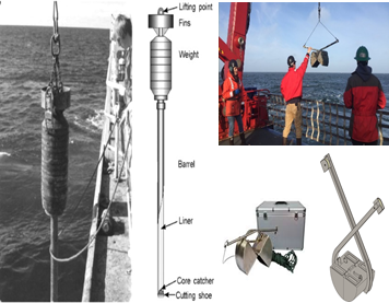
Geotechnical Equipment
Seabed soil investigation and sampling for foundation design.
- Vibrocoring
- CPT Systems
- Soil Sample Analysis
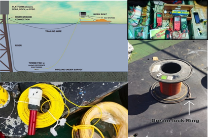
Cathodic Protection (CP) System
Specialized surveys to assess the effectiveness of cathodic protection on subsea pipelines and structures.
- Pipeline Integrity Assessment
- Towed Fish & ROV Systems
- Real-Time Data Acquisition
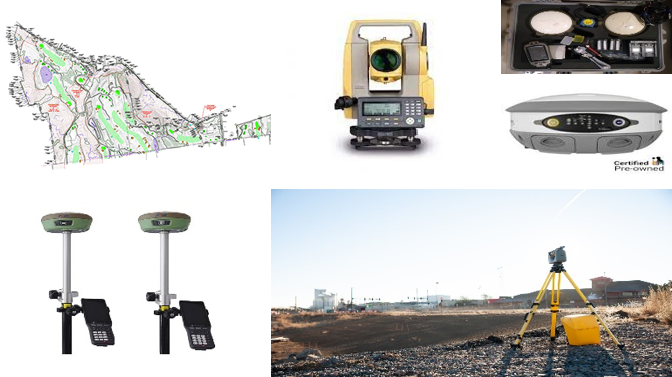
Total Station & RTK Systems
High-precision positioning systems for land and marine surveys.
- Topographic Mapping
- Construction Stakeout
- Real-Time Kinematic
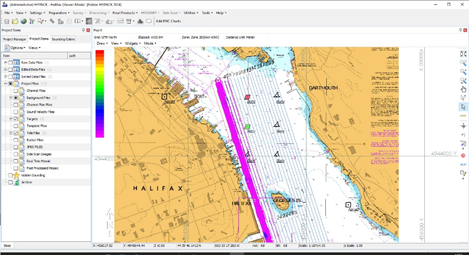
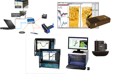
Software Suite
Professional-grade software for data acquisition, processing, and analysis.
QINSY Navigation Software
For navigation and SBES processing.
HYPACK Survey Software
For navigation and SBES processing.
EIVA Software Suite
For MBES processing and analysis.
GeoAcoustics Software
For MBES data processing.
C-View Software
Data acquisition for SSS and Seismic.
E-Survey CADD
For land surveying and CADD work.
Technology Excellence
Our commitment to innovation and precision in marine surveying
Industry-Leading Equipment
Latest technology from world-renowned manufacturers, calibrated to the highest standards.
Expert Operators
Highly trained professionals with extensive experience in operating advanced survey systems.
Quality Assurance
ISO certified processes ensuring data accuracy, traceability, and delivery for every project.
Start Your Next Project
Partner with us for precision business consulting solutions tailored to your requirements
Media & News
Stay up-to-date with our company's latest projects, events, and announcements.
More News
Media Resources
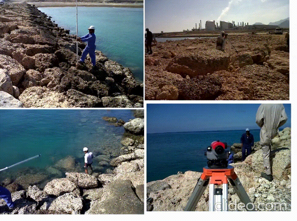
Field Images
View GalleryPhoto Gallery
View GalleryPress Inquiries
Members of the press can contact our communications team for interviews, statements, or additional information.
Contact Press OfficeMeet Our Leadership
The driving force behind our success, guiding our team with expertise and vision.


Current Openings
We are always looking for talented individuals to join our dynamic team. Explore our open positions below and find your next opportunity.
Hydrographic Surveyor
Geophysics
Engineers
Survey Engineer
CAD Processor
Don't see a fit?
We are always open to connecting with passionate professionals. If you believe your skills would be a great addition to our team, send us your resume.
Submit Your ResumeOur Projects
We specialize in market surveys, collaborating with government entities and top-tier private limited companies.
15+
Active Projects
200+
Completed Projects
10+
Countries Served
100%
Client Satisfaction
Current Projects
Ongoing initiatives demonstrating our commitment to excellence and innovation
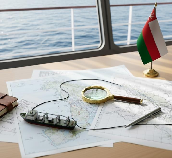
New Project with E-Marine in Oman
We are excited to announce our new project with E-Marine, a leader in submarine cable installation and maintenance. This project involves providing comprehensive survey services, including Dive Swim, Topographic, and Inshore surveys, at Barka, Oman. This contract highlights our growing presence in the Middle East and our expertise in supporting critical marine infrastructure projects.
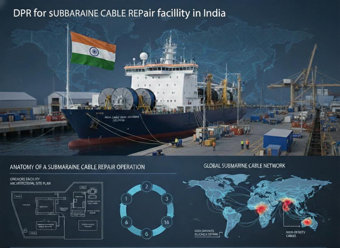
DPR for submarine cable repair facility in India
Acted as consultancy partner for the preparation of the Detailed Project Report (DPR) for an indigenous submarine cable repair facility in India. Providing technical expertise, project planning, and strategic recommendations.
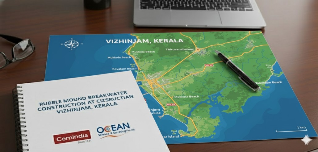
Rubble Mound Breakwater Construction at Vizhinjam, Kerala
We are pleased to partner with Cemindia Project Limited on the prestigious Vizhinjam Port project. Our role involves providing continuous, high-precision survey support for the construction of the Phase II and III Rubble Mound Breakwater.
DGPS for GTV SAMUDRA SARVEKSHAK
Provision of INMARSAT based differential global positioning system for ONGC owned Geotechnical Vessel (GTV) SAMUDRA SARVEKSHAK.
Hydrographic Surveys for National Waterways
Detailed Hydrographic Surveys for various National Waterways (NW-10, NW-28 & NW-53) in Maharashtra.
Project Portfolio
A comprehensive showcase of our recent project achievements
Our Expertise
Specialized solutions across diverse marine survey sectors.
Bathymetry
85+
Projects Completed
Geophysical
60+
Projects Completed
Positioning
45+
Projects Completed
Oceanography
55+
Projects Completed
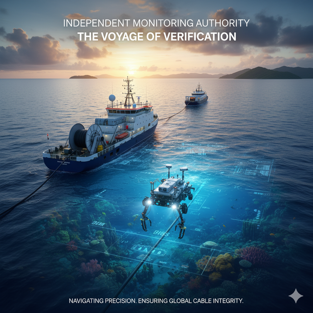
Independent Monitoring Authority
Supervision of Submarine Cable Route Projects
- Designated as the Independent Monitoring Authority in collaboration with TCTS, overseeing the Kochi – Lakshadweep Islands (KLI) Cable system on behalf of TCIL/BSNL/USOF/DOT.
- Responsible for monitoring marine components of the cable route survey project to ensure installation adheres to contractual specifications.
- Provided oversight for the AAE 1 cable route survey on behalf of SubCom.
Need Advanced Consulting Solutions?
Let our cutting-edge methodologies and experienced team deliver precision results for your project
Get in Touch
Ready to discuss your marine survey project? Our experts are here to help you achieve your goals.
Visit Office
Navi Mumbai, India
CBD Belapur, Tower # 8
Find Us Here
Visit our office in Navi Mumbai for an in-person consultation.
Frequently Asked Questions
Quick answers to common questions about our services
What is your typical project turnaround time?
Project timelines vary based on scope and complexity. Small projects typically take 1-2 weeks, while larger projects may take 4-8 weeks. We'll provide a detailed timeline during consultation.
Do you provide services internationally?
Yes, we operate globally with experience in multiple countries across Asia, Middle East, and Africa. Our team can mobilize to your project location worldwide.
What certifications do you hold?
We are ISO 9001:2015, ISO 14001:2015, ISO 45001:2018, and ISO 29001:2020 certified, ensuring the highest quality standards in business consulting.
Can I get a quote for my project?
Yes! Fill out the contact form above with your project details, or call us directly. We'll schedule a consultation to understand your requirements and provide a detailed quote.
Ready to Start Your Project?
Our team of experts is ready to provide tailored marine survey solutions for your unique requirements